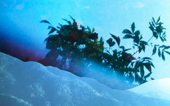
This is where I was. Images taken not for their image; the file data from walking around the West Bank in 2012, a month before Pillar of Smoke started in Gaza, of spending weeks lying on my back looking at planes under the Jordan flight path, stupidly thinking they were drones. Or getting up at 5 in the morning to get a bus somewhere to go for a walk, either with people or without people. Of going to 5th Century AD Greek Orthodox monasteries that ISIS would be burning today if they were there. Of badly avoiding being a tourist or NGO worker in one place and an interloping gentile in the other. Of not wanting to take any sense of identity with me, either as a colonial and especially as a privileged artist/ hired gun.
Images taken because of I have always distrusted the image and not because of the cultural value in critiquing the occupation of Palestine, or the cultural value in discussing remote controlled surveillance and targeted assassinations. Distrusting an image is one of the few rights that I have as a person and it is both my responsibility and job when I have to call myself an artist. Those positions are not immutable or fixed, and neither, I - or my emotions - are fixed. I wish I could be a better, more objective conceptual artist who is coolly detached from the shit of the world but that would be a lie. What is underneath the surface of an image or embedded into it is a part-rejection and a part-suspension of things, it started by rejecting the social pandemic of the question or assumption that in an image: quantity of labour equals quality of an argument. The social/ cultural obsession with production, labour, sheen and veneer... Now, the labour is in the data of an image.
Obtain the image’s GPS latitude/ longitude co-ordinates via info/ file data, alongside EXIF and TIFF data. On my computer, the data is available through Preview, not available in iPhoto, although each image also has a pin drop indexed to Google Earth via Facebook etc. I want to look at the written co-ordinates from the file and see where I have been and what is available. I don’t want a pin drop that drops and a social network is the most reliable source for keeping tabs on where you have been through your photos. Facebook and Twitter have been great for that.
“Multi-format discovery and processing. The ability to ingest and process different data types simultaneously. This key enabler for continued performance can minimize platform impact. If data formats, tags, and content are known for fielded systems and if processing and analytical algorithms and computing can interact with different data formats and types at the same time, then analyst workload can be reduced in discovery and reallocated to analysis while platforms can more synergistically update their products via middleware and in concert with other improvements possibly driven by obsolescence issues or related emerging performance needs.”
Of rejecting the following notion of “reducing in discovery” the analyst’s workload “and reallocated to analysis”. For people, the discovery is the analysis - and vice versa - the distinction is almost redundant. Reducing in discovery just means making it cheaper, faster, more efficient and more invasive; extending the practice of [military] advancement through conscious international legal violations. This is happening to the Internet and perpetual geospecific ambiguity of the law and high profile extraditions.
In 2009 The former head of the ILD, Colonel Daniel Reisner, spoke frankly to the Israeli media in the aftermath about the role the body plays in pushing the boundaries of what is acceptable in war.
"What we are seeing now is a revision of international law," Reisner said. "If you do something for long enough, the world will accept it. The whole of international law is now based on the notion that an act that is forbidden today becomes permissible if executed by enough countries…International law progresses through violations. We invented the targeted assassination thesis and we had to push it."
Who’s GPS data? Consider something as insane as an Israeli settler geocaching, in the context of data acquisition; of reducing the analyst’s workload and progression through international violations. Who in their right mind would walk with their children, recreationally, onto an armed, illegally occupied settlement advertising itself, telling people how fun it is to come there? To look for fake rocks and upload their GPS co-ordinates in a militarized zone? That millions of displaced Palestinians all over the world obviously cannot go there, a figure that would obviously exclude the Palestinian’s killed in acquiring the land, however you would like to describe that… as well as the Palestinians currently living in a life-threatening space already under military occupation. The illegal occupier uploads their GPS co-ordinates for leisure and advertises its presence (and logs it); it’s an occupying analyst’s wet dream and the “reducing in discovery” means less surveillance to the GPS co-ordinates - or potential targets - either by satellite or UAV.
“Geocache Description:
A medium cache in Alfei-Menashe. The catch located near the new neighborhood called "Hill Dew". The catch is in the ground level. There are colorfull pen and logbook. Enjoy the view :)
History: Alfei-Menashe was established in September 1983. The settlement is the most western in the Shomron area. At the beginning of the decade established a new neighborhood community that is supposed to double the number of its inhabitants. As of 2013, In Alfei-Menashe there were 8,036 residents. I'm living in the oldest neighborhood In Alfei-Menashe from birth. Before you navigate to the catch, you might have to change the setting in your GPS device because Alfei-Menashe is located 1-2 km east after the Green Line.”
“This is a great lookout. From this 864 meter high point, you can see all three of Israel's seas: The Mediterranean, The Dead Sea, and The Sea of Galilee.
But don't count on it, this spectacle can only be seen on a very clear day. The rest of the time you will still see a great view of the edge of the desert, from the green of the coastal plains to the yellow desert, as well as Shechem (Nablus) suburbs.
After visiting the area, you can also visit Itamar, the Givot Olam Farm, and/or the Samaritan community of Kiryat Luza.
The cache is right next to the road that connects Itamar and its daughter settlements, as so, one needs to drive through the Itamar gates, which are closed on the Sabbath and Jewish holidays. One can still get to the cache by a dirt road from the south or east of the cache, but you need to know what you are doing for this difficult maneuver.
Israelis should not enter Palestinian controlled areas, as it is illegal. And tourists should know that their rental car insurance probably doesn't cover driving in Area A, if the car was rented from an Israeli company. So don't enter areas marked by the red warning signs. Other than that, the road is considered safe, and plenty of Israelis drive there everyday. You can always call the local security hot line and ask about current conditions: 1-700-700-106.
Enjoy the hidden parts of Israel.”
WEST BANK (2012)
1. IMG_0596.JPG
Altitude: 830.742 m (2725.5 ft)
Altitude Reference: above sea level
Image Direction: 157.9425
Image Direction Reference: True direction
Latitude: 31° 53' 54" N
Longitude: 35° 11' 43.2" E
Time Stamp: 00:00:00.00
2. IMG_0598.JPG
Altitude: 844.852 m (2771.8 ft)
Altitude Reference: above sea level
Image Direction: 172.7537
Image Direction Reference: True direction
Latitude: 31° 53' 54.6" N
Longitude: 35° 11' 43.2" E
Time Stamp: 00:00:00.00
3. IMG_0605.jpg
Altitude: 841.803 m (2761.8 ft)
Altitude Reference: above sea level
Image Direction: 59.46621
Image Direction Reference: True direction
Latitude: 31° 53' 55.2" N
Longitude: 35° 11' 43.8" E
Time Stamp: 00:00:00.00
4. IMG_0608.jpg
Altitude: 841.803 m (2761.8 ft)
Altitude Reference: above sea level
Image Direction: 59.46621
Image Direction Reference: True direction
Latitude: 31° 53' 55.2" N
Longitude: 35° 11' 43.8" E
Time Stamp: 00:00:00.00
5. IMG_0609.JPG
Altitude: 750.94 m (2463.7 ft)
Altitude Reference: above sea level
Image Direction: 221.6241
Image Direction Reference: True direction
Latitude: 31° 46' 55.2" N
Longitude: 35° 13' 47.4" E
Time Stamp: 00:00:00.00
6. IMG_0613.JPG
Altitude: 769.998 m (2526.2 ft)
Altitude Reference: above sea level
Image Direction: 310.4948
Image Direction Reference: True direction
Latitude: 31° 46' 23.4" N
Longitude: 35° 12' 9" E
Time Stamp: 00:00:00.00
7. IMG_0615.JPG
Altitude: 777.215 m (2549.9 ft)
Altitude Reference: above sea level
Image Direction: 1.138214
Image Direction Reference: True direction
Latitude: 31° 46' 22.8" N
Longitude: 35° 12' 8.4" E
Time Stamp: 00:00:00.00
8. IMG_0618.JPG
Altitude: 812.636 m (2666.1 ft)
Altitude Reference: above sea level
Image Direction: 168.8556
Image Direction Reference: True direction
Latitude: 31° 46' 24.6" N
Longitude: 35° 12' 8.4" E
Time Stamp: 00:00:00.00
9. IMG_0619.JPG
Altitude: 797.095 m (2615.1 ft)
Altitude Reference: above sea level
Image Direction: 211.8556
Image Direction Reference: True direction
Latitude: 31° 46' 24" N
Longitude: 35° 12' 7.8" E
Time Stamp: 00:00:00.00
10.IMG_0620.JPG
Altitude: 803.405 m (2635.8 ft)
Altitude Reference: above sea level
Image Direction: 237.8891
Image Direction Reference: True direction
Latitude: 31° 46' 24" N
Longitude: 35° 12' 8.4" E
Time Stamp: 00:00:00.00
11.IMG_0621.JPG
Altitude: 779.944 m (2558.9 ft)
Altitude Reference: above sea level
Image Direction: 266.7339
Image Direction Reference: True direction
Latitude: 31° 46' 24" N
Longitude: 35° 12' 8.4" E
Time Stamp: 00:00:00.00
12.IMG_0622.JPG
Altitude: 754.636 m (2475.8 ft)
Altitude Reference: above sea level
Image Direction: 283.6949
Image Direction Reference: True direction
Latitude: 31° 46' 23.4" N
Longitude: 35° 12' 8.4" E
Time Stamp: 00:00:00.00
13.IMG_0624.jpg
Altitude: 787.08 m (2582.3 ft)
Altitude Reference: above sea level
Image Direction: 16.77303
Image Direction Reference: True direction
Latitude: 31° 46' 22.2" N
Longitude: 35° 12' 15" E
Time Stamp: 00:00:00.00
14.IMG_0625.JPG
Altitude: 826.634 m (2712.1 ft)
Altitude Reference: above sea level
Latitude: 31° 46' 22.2" N
Longitude: 35° 12' 14.4" E
Time Stamp: 00:00:00.00
15.IMG_0628.jpg
Altitude: 777.725 m (2551.6 ft)
Altitude Reference: above sea level
Image Direction: 34.5378
Image Direction Reference: True direction
Latitude: 31° 46' 37.2" N
Longitude: 35° 13' 46.2" E
Time Stamp: 00:00:00.00
16.IMG_0629.jpg
NO DATA
17.IMG_0631.jpg
NO DATA
18.IMG_0633.jpg
NO DATA
19.IMG_0635.JPG
NO DATA
20.IMG_0636.jpg
NO DATA
21.IMG_0646.JPG
Altitude: 812.054 m (2664.2 ft)
Altitude Reference: above sea level
Image Direction: 2.430023
Image Direction Reference: True direction
Latitude: 31° 53' 55.2" N
Longitude: 35° 11' 43.8" E
Time Stamp: 00:00:00.00
22.IMG_0647.JPG
Altitude: 812.054 m (2664.2 ft)
Altitude Reference: above sea level
Image Direction: 316.5217
Image Direction Reference: True direction
Latitude: 31° 53' 55.2" N
Longitude: 35° 11' 43.8" E
Time Stamp: 00:00:00.00
23.IMG_0648.JPG
Altitude: 855.152 m (2805.6 ft)
Altitude Reference: above sea level
Image Direction: 30.82941
Image Direction Reference: True direction
Latitude: 31° 53' 56.4" N
Longitude: 35° 11' 43.8" E
Time Stamp: 00:00:00.00
24.IMG_0649.JPG
Altitude: 851.971 m (2795.2 ft)
Altitude Reference: above sea level
Image Direction: 2.829407
Image Direction Reference: True direction
Latitude: 31° 53' 56.4" N
Longitude: 35° 11' 43.2" E
Time Stamp: 00:00:00.00
25.IMG_0651.jpg
Altitude: 80.3622 m (263.7 ft)
Altitude Reference: above sea level
Image Direction: 212.7239
Image Direction Reference: True direction
Latitude: 32° 1' 29.4" N
Longitude: 35° 6' 13.2" E
Time Stamp: 00:00:00.00
26.IMG_0653.JPG
Altitude: 509.579 m (1671.8 ft)
Altitude Reference: above sea level
Image Direction: 279.9757
Image Direction Reference: True direction
Latitude: 32° 1' 30.6" N
Longitude: 35° 6' 9.6" E
Time Stamp: 00:00:00.00
27.IMG_0656.JPG
Altitude: 449.452 m (1474.6 ft)
Altitude Reference: above sea level
Image Direction: 310.9179
Image Direction Reference: True direction
Latitude: 32° 1' 22.8" N
Longitude: 35° 6' 3.6" E
Time Stamp: 00:00:00.00
28.IMG_0658.JPG
Altitude: 489.313 m (1605.4 ft)
Altitude Reference: above sea level
Image Direction: 203.8268
Image Direction Reference: True direction
Latitude: 32° 1' 21.6" N
Longitude: 35° 5' 56.4" E
Time Stamp: 00:00:00.00
29.IMG_0660.JPG
Altitude: 440.873 m (1446.4 ft)
Altitude Reference: above sea level
Image Direction: 346.3501
Image Direction Reference: True direction
Latitude: 32° 1' 37.2" N
Longitude: 35° 5' 42" E
Time Stamp: 00:00:00.00
30.IMG_0661.JPG
NO DATA
31.IMG_0662.JPG
Altitude: 210.033 m (689.1 ft)
Altitude Reference: above sea level
Image Direction: 322.2523
Image Direction Reference: True direction
Latitude: 32° 2' 15" N
Longitude: 35° 3' 42.6" E
Time Stamp: 00:00:00.00
32.IMG_0663.JPG
Altitude: 189.03 m (620.2 ft)
Altitude Reference: above sea level
Image Direction: 328.6588
Image Direction Reference: True direction
Latitude: 32° 2' 24" N
Longitude: 35° 3' 20.4" E
Time Stamp: 00:00:00.00
33.IMG_0664.JPG
Altitude: 169.44 m (555.9 ft)
Altitude Reference: above sea level
Image Direction: 303.9295
Image Direction Reference: True direction
Latitude: 32° 2' 36" N
Longitude: 35° 3' 10.8" E
Time Stamp: 00:00:00.00
34.IMG_0665.JPG
Altitude: 794.419 m (2606.4 ft)
Altitude Reference: above sea level
Latitude: 31° 46' 34.8" N
Longitude: 35° 14' 35.4" E
Time Stamp: 00:00:00.00
35.IMG_0666.JPG
Altitude: 786.242 m (2579.5 ft)
Altitude Reference: above sea level
Latitude: 31° 46' 34.2" N
Longitude: 35° 14' 35.4" E
Time Stamp: 00:00:00.00
36.IMG_0667.jpg
NO DATA
37.IMG_0668.JPG
Altitude: 841.959 m (2762.3 ft)
Altitude Reference: above sea level
Image Direction: 210.4858
Image Direction Reference: True direction
Latitude: 31° 54' 2.4" N
Longitude: 35° 11' 54.6" E
Time Stamp: 00:00:00.00
38.IMG_0669.JPG
Altitude: 839.145 m (2753.1 ft)
Altitude Reference: above sea level
Image Direction: 160.8966
Image Direction Reference: True direction
Latitude: 31° 54' 2.4" N
Longitude: 35° 11' 54" E
Time Stamp: 00:00:00.00
39.IMG_0670.jpg
Altitude: 850.398 m (2790.0 ft)
Altitude Reference: above sea level
Image Direction: 112.9987
Image Direction Reference: True direction
Latitude: 31° 54' 6" N
Longitude: 35° 11' 38.4" E
Time Stamp: 00:00:00.00
40.IMG_0671.JPG
Altitude: 842.716 m (2764.8 ft)
Altitude Reference: above sea level
Image Direction: 319.3151
Image Direction Reference: True direction
Latitude: 31° 53' 55.8" N
Longitude: 35° 11' 43.2" E
Time Stamp: 00:00:00.00
41.IMG_0675.JPG
Altitude: 844.943 m (2772.1 ft)
Altitude Reference: above sea level
Image Direction: 294.0418
Image Direction Reference: True direction
Latitude: 31° 53' 55.8" N
Longitude: 35° 11' 43.2" E
Time Stamp: 00:00:00.00
42.IMG_0676.JPG
Altitude: 844.621 m (2771.1 ft)
Altitude Reference: above sea level
Image Direction: 294.0418
Image Direction Reference: True direction
Latitude: 31° 53' 55.8" N
Longitude: 35° 11' 43.2" E
Time Stamp: 00:00:00.00
43.IMG_0692.JPG
Altitude: 326.461 m (1071.1 ft)
Altitude Reference: above sea level
Image Direction: 192.4797
Image Direction Reference: True direction
Latitude: 31° 52' 37.2" N
Longitude: 35° 3' 5.4" E
Time Stamp: 00:00:00.00
44.IMG_0693.JPG
Altitude: 323.328 m (1060.8 ft)
Altitude Reference: above sea level
Image Direction: 192.1708
Image Direction Reference: True direction
Latitude: 31° 52' 37.8" N
Longitude: 35° 3' 6" E
Time Stamp: 00:00:00.00
45.IMG_0694.JPG
Altitude: 324.126 m (1063.4 ft)
Altitude Reference: above sea level
Image Direction: 248.2852
Image Direction Reference: True direction
Latitude: 31° 52' 39" N
Longitude: 35° 3' 3.6" E
Time Stamp: 00:00:00.00
46.IMG_0696.JPG
Altitude: 296.465 m (972.7 ft)
Altitude Reference: above sea level
Image Direction: 232.0111
Image Direction Reference: True direction
Latitude: 31° 52' 48.6" N
Longitude: 35° 2' 39.6" E
Time Stamp: 00:00:00.00
47.IMG_0698.JPG
NO DATA
48.IMG_0700.JPG
NO DATA
49.IMG_0701.JPG
Altitude: 827.893 m (2716.2 ft)
Altitude Reference: above sea level
Image Direction: 266.0145
Image Direction Reference: True direction
Latitude: 31° 53' 55.8" N
Longitude: 35° 11' 44.4" E
Time Stamp: 00:00:00.00
50.IMG_0706.JPG
Altitude: 761.412 m (2498.1 ft)
Altitude Reference: above sea level
Latitude: 31° 51' 43.8" N
Longitude: 35° 13' 37.8" E
Time Stamp: 00:00:00.00
51.IMG_0707.JPG
Altitude: 751.404 m (2465.2 ft)
Altitude Reference: above sea level
Image Direction: 227.1638
Image Direction Reference: True direction
Latitude: 31° 51' 42.6" N
Longitude: 35° 13' 36" E
Time Stamp: 00:00:00.00
52.IMG_0708.jpg
Altitude: 779.711 m (2558.1 ft)
Altitude Reference: above sea level
Image Direction: 97.64165
Image Direction Reference: True direction
Latitude: 31° 47' 24" N
Longitude: 35° 13' 45.6" E
Time Stamp: 00:00:00.00
53.IMG_0715.jpg
Altitude: 598.147 m (1962.4 ft)
Altitude Reference: above sea level
Image Direction: 239.0155
Image Direction Reference: True direction
Latitude: 32° 13' 6.6" N
Longitude: 35° 15' 42.6" E
Time Stamp: 00:00:00.00
54.IMG_0717.jpg
Altitude: 546.266 m (1792.2 ft)
Altitude Reference: above sea level
Image Direction: 176.5965
Image Direction Reference: True direction
Latitude: 32° 13' 7.8" N
Longitude: 35° 15' 42" E
Time Stamp: 00:00:00.00
55.IMG_0718.jpg
Altitude: 546.266 m (1792.2 ft)
Altitude Reference: above sea level
Image Direction: 126.0282
Image Direction Reference: True direction
Latitude: 32° 13' 7.8" N
Longitude: 35° 15' 42" E
Time Stamp: 00:00:00.00
56.IMG_0720.JPG
NO DATA
57.IMG_0721.jpg
NO DATA
58.IMG_0722.jpg
NO DATA
59.IMG_0723.jpg
NO DATA
60.IMG_0724.JPG
Altitude: 41.3525 m (135.7 ft)
Altitude Reference: above sea level
Image Direction: 229.0821
Image Direction Reference: True direction
Latitude: 32° 13' 3.6" N
Longitude: 35° 15' 31.8" E
Time Stamp: 00:00:00.00
61.IMG_0725.jpg
NO DATA
62.IMG_0727.jpg
NO DATA
63.IMG_0728.jpg
Altitude: 607.856 m (1994.3 ft)
Altitude Reference: above sea level
Image Direction: 206.0681
Image Direction Reference: True direction
Latitude: 32° 13' 6.6" N
Longitude: 35° 15' 30.6" E
Time Stamp: 00:00:00.00
64.IMG_0729.JPG
NO DATA
65.IMG_0730.JPG
NO DATA
66.IMG_0731.JPG
NO DATA
67.IMG_0733.jpg
NO DATA
68.IMG_0734.jpg
Altitude: 560.774 m (1839.8 ft)
Altitude Reference: above sea level
Latitude: 32° 13' 9" N
Longitude: 35° 15' 26.4" E
Time Stamp: 00:00:00.00
69.IMG_0735.JPG
Altitude: 560.774 m (1839.8 ft)
Altitude Reference: above sea level
Image Direction: 203.577
Image Direction Reference: True direction
Latitude: 32° 13' 9" N
Longitude: 35° 15' 26.4" E
Time Stamp: 00:00:00.00
70.IMG_0736.jpg
NO DATA
71.IMG_0741.JPG
Altitude: 582.995 m (1912.7 ft)
Altitude Reference: above sea level
Image Direction: 214.3561
Image Direction Reference: True direction
Latitude: 32° 13' 15" N
Longitude: 35° 15' 38.4" E
Time Stamp: 00:00:00.00
72.IMG_0750.jpg
Altitude: 838.184 m (2749.9 ft)
Altitude Reference: above sea level
Image Direction: 294.3642
Image Direction Reference: Magnetic direction
Latitude: 31° 53' 56.4" N
Longitude: 35° 11' 43.2" E
Time Stamp: 00:00:00.00
73.IMG_0751.jpg
Altitude: 830.344 m (2724.2 ft)
Altitude Reference: above sea level
Image Direction: 46.61061
Image Direction Reference: True direction
Latitude: 31° 53' 54.6" N
Longitude: 35° 11' 43.2" E
Time Stamp: 00:00:00.00
74.IMG_0752.jpg
Altitude: 832.044 m (2729.8 ft)
Altitude Reference: above sea level
Image Direction: 75.1545
Image Direction Reference: True direction
Latitude: 31° 53' 55.2" N
Longitude: 35° 11' 43.2" E
Time Stamp: 00:00:00.00
75.IMG_0753.JPG
Altitude: 779.747 m (2558.2 ft)
Altitude Reference: above sea level
Image Direction: 256.1049
Image Direction Reference: True direction
Latitude: 31° 58' 15.6" N
Longitude: 35° 11' 48" E
Time Stamp: 00:00:00.00
76.IMG_0754.JPG
Altitude: 794.555 m (2606.8 ft)
Altitude Reference: above sea level
Image Direction: 304.0342
Image Direction Reference: True direction
Latitude: 31° 58' 15" N
Longitude: 35° 11' 49.2" E
Time Stamp: 00:00:00.00
77.IMG_0758.JPG
Altitude: 28.9719 m (95.1 ft)
Altitude Reference: above sea level
Image Direction: 333.8445
Image Direction Reference: True direction
Latitude: 32° 3' 21.6" N
Longitude: 34° 45' 19.8" E
Time Stamp: 00:00:00.00
78.IMG_0759.JPG
Altitude: 17.1268 m (56.2 ft)
Altitude Reference: above sea level
Image Direction: 244.6295
Image Direction Reference: True direction
Latitude: 32° 3' 21.6" N
Longitude: 34° 45' 19.2" E
Time Stamp: 00:00:00.00
79.IMG_0761.JPG
Altitude: 28.2683 m (92.7 ft)
Altitude Reference: above sea level
Image Direction: 147.6265
Image Direction Reference: True direction
Latitude: 32° 3' 11.4" N
Longitude: 34° 45' 3.6" E
Time Stamp: 00:00:00.00
80.IMG_0762.JPG
Altitude: 28.5516 m (93.7 ft)
Altitude Reference: above sea level
Image Direction: 34.87677
Image Direction Reference: True direction
Latitude: 32° 3' 15" N
Longitude: 34° 45' 11.4" E
Time Stamp: 00:00:00.00
81.IMG_0763.JPG
Altitude: 23.8255 m (78.2 ft)
Altitude Reference: above sea level
Image Direction: 324.465
Image Direction Reference: True direction
Latitude: 32° 3' 15.6" N
Longitude: 34° 45' 10.2" E
Time Stamp: 00:00:00.00
82.IMG_0766.JPG
Altitude: 0 m (0.0 ft)
Altitude Reference: above sea level
Image Direction: 171.4634
Image Direction Reference: True direction
Latitude: 32° 3' 19.8" N
Longitude: 34° 45' 15.6" E
Time Stamp: 00:00:00.00
83.IMG_0767.JPG
Altitude: 0 m (0.0 ft)
Altitude Reference: above sea level
Image Direction: 35.46344
Image Direction Reference: True direction
Latitude: 32° 3' 19.8" N
Longitude: 34° 45' 15.6" E
Time Stamp: 00:00:00.00
84.IMG_0770.JPG
NO DATA
85.IMG_0771.JPG
Altitude: 152.387 m (500.0 ft)
Altitude Reference: above sea level
Image Direction: 354.8448
Image Direction Reference: True direction
Latitude: 31° 49' 14.4" N
Longitude: 35° 23' 21.6" E
Time Stamp: 00:00:00.00
86.IMG_0772.JPG
NO DATA
87.IMG_0774.JPG
Altitude: 158.697 m (520.7 ft)
Altitude Reference: above sea level
Image Direction: 54.2374
Image Direction Reference: True direction
Latitude: 31° 49' 37.8" N
Longitude: 35° 23' 15" E
Time Stamp: 00:00:00.00
88.IMG_0775.JPG
Altitude: 152.583 m (500.6 ft)
Altitude Reference: above sea level
Image Direction: 301.2374
Image Direction Reference: True direction
Latitude: 31° 49' 38.4" N
Longitude: 35° 23' 15" E
Time Stamp: 00:00:00.00
89.IMG_0776.JPG
Altitude: 69.3569 m (227.5 ft)
Altitude Reference: above sea level
Image Direction: 1.657959
Image Direction Reference: True direction
Latitude: 31° 49' 57" N
Longitude: 35° 23' 21.6" E
Time Stamp: 00:00:00.00
90.IMG_0777.JPG
Altitude: 38.8967 m (127.6 ft)
Altitude Reference: above sea level
Image Direction: 357.658
Image Direction Reference: True direction
Latitude: 31° 49' 57.6" N
Longitude: 35° 23' 21.6" E
Time Stamp: 00:00:00.00
91.IMG_0778.JPG
Altitude: 0 m (0.0 ft)
Altitude Reference: below sea level
Image Direction: 178.7223
Image Direction Reference: True direction
Latitude: 31° 50' 4.2" N
Longitude: 35° 23' 32.4" E
Time Stamp: 00:00:00.00
92.IMG_0779.jpg
Altitude: 0 m (0.0 ft)
Altitude Reference: below sea level
Image Direction: 9.152548
Image Direction Reference: True direction
Latitude: 31° 50' 4.8" N
Longitude: 35° 23' 32.4" E
Time Stamp: 00:00:00.00
93.IMG_0780.jpg
Altitude: 0 m (0.0 ft)
Altitude Reference: below sea level
Image Direction: 11.83139
Image Direction Reference: True direction
Latitude: 31° 50' 5.4" N
Longitude: 35° 23' 32.4" E
Time Stamp: 00:00:00.00
94.IMG_0781.jpg
NO DATA
95.IMG_0782.jpg
Altitude: 427.147 m (1401.4 ft)
Altitude Reference: above sea level
Latitude: 31° 50' 4.2" N
Longitude: 35° 23' 41.4" E
Time Stamp: 00:00:00.00
96.IMG_0784.jpg
Altitude: 217.826 m (714.7 ft)
Altitude Reference: above sea level
Image Direction: 52.18396
Image Direction Reference: True direction
Latitude: 31° 50' 4.8" N
Longitude: 35° 23' 41.4" E
Time Stamp: 00:00:00.00
97.IMG_0786.JPG
NO DATA
98.IMG_0787.JPG
Altitude: 32.477 m (106.6 ft)
Altitude Reference: above sea level
Image Direction: 46.68893
Image Direction Reference: True direction
Latitude: 31° 50' 18.6" N
Longitude: 35° 24' 1.8" E
Time Stamp: 00:00:00.00
99.IMG_0788.JPG
Altitude: 32.477 m (106.6 ft)
Altitude Reference: above sea level
Image Direction: 43.08356
Image Direction Reference: True direction
Latitude: 31° 50' 18.6" N
Longitude: 35° 24' 1.8" E
Time Stamp: 00:00:00.00
100. IMG_0789.JPG
NO DATA
101. IMG_0790.JPG
Altitude: 0 m (0.0 ft)
Altitude Reference: below sea level
Image Direction: 66.68365
Image Direction Reference: True direction
Latitude: 31° 50' 23.4" N
Longitude: 35° 24' 31.8" E
Time Stamp: 00:00:00.00
102. IMG_0791.jpg
Altitude: 0 m (0.0 ft)
Altitude Reference: below sea level
Image Direction: 54.37168
Image Direction Reference: True direction
Latitude: 31° 50' 23.4" N
Longitude: 35° 24' 31.8" E
Time Stamp: 00:00:00.00
103. IMG_0793.jpg
Altitude: 0 m (0.0 ft)
Altitude Reference: below sea level
Image Direction: 83.83975
Image Direction Reference: True direction
Latitude: 31° 50' 23.4" N
Longitude: 35° 24' 32.4" E
Time Stamp: 00:00:00.00
104. IMG_0795.jpg
Altitude: 0 m (0.0 ft)
Altitude Reference: below sea level
Latitude: 31° 50' 28.2" N
Longitude: 35° 24' 37.2" E
Time Stamp: 00:00:00.00
105. IMG_0796.JPG
Altitude: 0 m (0.0 ft)
Altitude Reference: below sea level
Image Direction: 101.9367
Image Direction Reference: True direction
Latitude: 31° 50' 28.2" N
Longitude: 35° 24' 37.2" E
Time Stamp: 00:00:00.00
106. IMG_0797.jpg
Altitude: 0 m (0.0 ft)
Altitude Reference: below sea level
Image Direction: 8.446489
Image Direction Reference: True direction
Latitude: 31° 50' 29.4" N
Longitude: 35° 24' 37.8" E
Time Stamp: 00:00:00.00
107. IMG_0798.JPG
Altitude: 0 m (0.0 ft)
Altitude Reference: below sea level
Image Direction: 8.657135
Image Direction Reference: True direction
Latitude: 31° 50' 31.2" N
Longitude: 35° 24' 40.8" E
Time Stamp: 00:00:00.00
108. IMG_0799.jpg
Altitude: 0 m (0.0 ft)
Altitude Reference: below sea level
Image Direction: 20.17255
Image Direction Reference: True direction
Latitude: 31° 50' 31.8" N
Longitude: 35° 24' 41.4" E
Time Stamp: 00:00:00.00
109. IMG_0800.jpg
NO DATA
110. IMG_0803.jpg
Altitude: 22.7927 m (74.8 ft)
Altitude Reference: above sea level
Image Direction: 89.18508
Image Direction Reference: True direction
Latitude: 31° 50' 43.2" N
Longitude: 35° 24' 46.2" E
Time Stamp: 00:00:00.00
111. IMG_0804.jpg
Altitude: 22.7927 m (74.8 ft)
Altitude Reference: above sea level
Image Direction: 84.8498
Image Direction Reference: True direction
Latitude: 31° 50' 43.2" N
Longitude: 35° 24' 46.2" E
Time Stamp: 00:00:00.00
112. IMG_0805.jpg
Altitude: 22.7927 m (74.8 ft)
Altitude Reference: above sea level
Image Direction: 188.3562
Image Direction Reference: True direction
Latitude: 31° 50' 43.2" N
Longitude: 35° 24' 46.2" E
Time Stamp: 00:00:00.00
113. IMG_0806.jpg
Altitude: 0 m (0.0 ft)
Altitude Reference: below sea level
Image Direction: 51.92269
Image Direction Reference: True direction
Latitude: 31° 50' 45.6" N
Longitude: 35° 24' 50.4" E
Time Stamp: 00:00:00.00
114. IMG_0807.jpg
Altitude: 111.615 m (366.2 ft)
Altitude Reference: above sea level
Image Direction: 53.92269
Image Direction Reference: True direction
Latitude: 31° 50' 53.4" N
Longitude: 35° 25' 0" E
Time Stamp: 00:00:00.00
115. IMG_0808.JPG
Altitude: 126.063 m (413.6 ft)
Altitude Reference: above sea level
Image Direction: 159.7585
Image Direction Reference: True direction
Latitude: 31° 51' 0" N
Longitude: 35° 25' 24" E
Time Stamp: 00:00:00.00
116. IMG_0809.jpg
Altitude: 0 m (0.0 ft)
Altitude Reference: below sea level
Image Direction: 71.92508
Image Direction Reference: True direction
Latitude: 31° 50' 58.2" N
Longitude: 35° 25' 24.6" E
Time Stamp: 00:00:00.00
117. IMG_0810.JPG
Altitude: 0 m (0.0 ft)
Altitude Reference: below sea level
Image Direction: 195.0816
Image Direction Reference: True direction
Latitude: 31° 51' 21.6" N
Longitude: 35° 27' 37.2" E
Time Stamp: 00:00:00.00
118. IMG_0824.JPG
Altitude: 805.643 m (2643.2 ft)
Altitude Reference: above sea level
Latitude: 31° 46' 49.8" N
Longitude: 35° 13' 56.4" E
Time Stamp: 00:00:00.00
119. IMG_0825.JPG
Altitude: 773.072 m (2536.3 ft)
Altitude Reference: above sea level
Image Direction: 150.9989
Image Direction Reference: True direction
Latitude: 31° 46' 49.2" N
Longitude: 35° 13' 56.4" E
Time Stamp: 00:00:00.00
120. IMG_0826.JPG
Altitude: 780.716 m (2561.4 ft)
Altitude Reference: above sea level
Image Direction: 215.6861
Image Direction Reference: True direction
Latitude: 31° 46' 49.8" N
Longitude: 35° 13' 56.4" E
Time Stamp: 00:00:00.00
121. IMG_0827.JPG
Altitude: 758.09 m (2487.2 ft)
Altitude Reference: above sea level
Image Direction: 91.76467
Image Direction Reference: True direction
Latitude: 31° 46' 36" N
Longitude: 35° 14' 0.6" E
Time Stamp: 00:00:00.00
122. IMG_0829.JPG
Altitude: 767.409 m (2517.7 ft)
Altitude Reference: above sea level
Image Direction: 347.8537
Image Direction Reference: True direction
Latitude: 31° 47' 21.6" N
Longitude: 35° 13' 45" E
Time Stamp: 00:00:00.00
123. IMG_0831.JPG
Altitude: 853.321 m (2799.6 ft)
Altitude Reference: above sea level
Image Direction: 249.614
Image Direction Reference: True direction
Latitude: 31° 53' 55.2" N
Longitude: 35° 11' 42.6" E
Time Stamp: 00:00:00.00
124. IMG_0836.JPG
Altitude: 839.441 m (2754.1 ft)
Altitude Reference: above sea level
Image Direction: 0.1800842
Image Direction Reference: True direction
Latitude: 31° 41' 40.2" N
Longitude: 35° 11' 12.6" E
Time Stamp: 00:00:00.00
125. IMG_0855.JPG
Altitude: 845.3 m (2773.3 ft)
Altitude Reference: above sea level
Image Direction: 309.5792
Image Direction Reference: True direction
Latitude: 31° 53' 55.2" N
Longitude: 35° 11' 42.6" E
Time Stamp: 00:00:00.00
126. IMG_0856.JPG
Altitude: 828.325 m (2717.6 ft)
Altitude Reference: above sea level
Image Direction: 261.5792
Image Direction Reference: True direction
Latitude: 31° 53' 55.2" N
Longitude: 35° 11' 42.6" E
Time Stamp: 00:00:00.00
127. IMG_0857.jpg
Altitude: 831.69 m (2728.6 ft)
Altitude Reference: above sea level
Image Direction: 258.5792
Image Direction Reference: True direction
Latitude: 31° 53' 55.2" N
Longitude: 35° 11' 43.2" E
Time Stamp: 00:00:00.00
128. IMG_0858.jpg
Altitude: 830.53 m (2724.8 ft)
Altitude Reference: above sea level
Image Direction: 298.9464
Image Direction Reference: True direction
Latitude: 31° 53' 55.2" N
Longitude: 35° 11' 43.2" E
Time Stamp: 00:00:00.00
129. IMG_0859.jpg
Altitude: 839.305 m (2753.6 ft)
Altitude Reference: above sea level
Image Direction: 339.2759
Image Direction Reference: True direction
Latitude: 31° 53' 55.2" N
Longitude: 35° 11' 43.2" E
Time Stamp: 00:00:00.00
LEBANON (2013)
1. DSC00070.JPG
NO DATA
2. DSC00071.JPG
NO DATA
3. DSC00072.JPG
NO DATA
4. DSC00073.JPG
NO DATA
5. DSC00074.JPG
NO DATA
6. DSC00075.JPG
NO DATA
7. DSC00076.JPG
NO DATA
8. DSC00077.jpg
NO DATA
9. DSC00078.jpg
NO DATA
10.DSC00080.jpg
NO DATA
11.DSC00081.JPG
NO DATA
12.DSC00082.jpg
NO DATA
13.DSC00083.JPG
NO DATA
14.DSC00086.jpg
NO DATA
15.DSC00087.JPG
NO DATA
16.DSC00088.JPG
NO DATA
17.DSC00089.JPG
NO DATA
18.DSC00090.JPG
NO DATA
19.DSC00091.JPG
NO DATA
20.DSC00092.JPG
NO DATA
21.DSC00094.JPG
NO DATA
22.DSC00099.JPG
NO DATA
23.DSC00100.JPG
NO DATA
24.DSC00101.JPG
NO DATA
25.DSC00105.jpg
NO DATA
26.DSC00141.JPG
NO DATA
27.DSC00142.jpg
NO DATA
28.DSC00143.JPG
NO DATA
29.DSC00144.JPG
NO DATA
30.DSC00145.JPG
NO DATA
31.DSC00147.JPG
NO DATA
32.DSC00148.JPG
NO DATA
33.DSC00149.JPG
NO DATA
34.DSC00150.jpg
NO DATA
35.DSC00151.JPG
NO DATA
36.DSC00152.JPG
NO DATA
37.DSC00153.JPG
NO DATA
38.DSC00154.JPG
NO DATA
39.DSC00155.jpg
NO DATA
40.DSC00156.JPG
NO DATA
41.DSC00157.jpg
NO DATA
42.DSC00158.jpg
NO DATA
43.DSC00161.JPG
NO DATA
44.DSC00162.JPG
NO DATA
45.DSC00163.JPG
NO DATA
46.DSC00164.JPG
NO DATA
47.DSC00165.JPG
NO DATA
48.DSC00166.JPG
NO DATA
49.DSC00167.JPG
NO DATA
50.DSC00168.JPG
NO DATA
51.DSC00169.JPG
NO DATA
52.DSC00170.JPG
NO DATA
53.DSC00171.JPG
NO DATA
54.DSC00172.JPG
NO DATA
55.DSC00173.JPG
NO DATA
56.DSC00174.JPG
NO DATA
57.DSC00175.JPG
NO DATA
58.DSC00177.JPG
NO DATA
59.DSC00178.JPG
NO DATA
60.DSC00179.JPG
NO DATA
61.DSC00180.JPG
NO DATA
62.DSC00182.JPG
NO DATA
63.DSC00183.JPG
NO DATA
64.DSC00184.JPG
NO DATA
65.DSC00185.JPG
NO DATA
66.DSC00186.JPG
NO DATA
67.DSC00187.JPG
NO DATA
68.DSC00188.JPG
NO DATA
69.DSC00189.JPG
NO DATA
70.DSC00191.JPG
NO DATA
71.DSC00194.JPG
NO DATA
72.DSC00195.JPG
NO DATA
73.DSC00200.JPG
NO DATA
74.DSC00201.JPG
NO DATA
75.DSC00203.JPG
NO DATA
76.DSC00204.JPG
NO DATA
77.DSC00226.JPG
NO DATA
78.IMG_0961.jpg
NO DATA
79.IMG_0963.jpg
Altitude: 70.4165 m (231.0 ft)
Altitude Reference: above sea level
Latitude: 33° 0' 0" N
Longitude: 35° 29' 45.6" E
Speed: 0
Speed Reference: Kilometers per hour
Track: 0
Track Reference: True direction
80.IMG_0965.jpg
Altitude: 137.526 m (451.2 ft)
Altitude Reference: above sea level
Latitude: 33° 53' 36.6" N
Longitude: 35° 29' 45" E
Time Stamp: 00:00:00.00
81.IMG_0966.jpg
Altitude: 72.1171 m (236.6 ft)
Altitude Reference: above sea level
Image Direction: 203.3694
Image Direction Reference: True direction
Latitude: 33° 53' 37.2" N
Longitude: 35° 29' 45" E
Time Stamp: 00:00:00.00
82.IMG_0967.JPG
Altitude: 82.4213 m (270.4 ft)
Altitude Reference: above sea level
Image Direction: 215.981
Image Direction Reference: True direction
Latitude: 33° 53' 37.2" N
Longitude: 35° 29' 45" E
Time Stamp: 00:00:00.00
83.IMG_0969.jpg
Altitude: 92.4017 m (303.2 ft)
Altitude Reference: above sea level
Image Direction: 122.6405
Image Direction Reference: True direction
Latitude: 33° 53' 46.2" N
Longitude: 35° 29' 16.2" E
Time Stamp: 00:00:00.00
84.IMG_0970.jpg
Altitude: 70.5652 m (231.5 ft)
Altitude Reference: above sea level
Latitude: 33° 53' 38.4" N
Longitude: 35° 29' 45" E
Time Stamp: 00:00:00.00
85.IMG_0971.jpg
Altitude: 94.8225 m (311.1 ft)
Altitude Reference: above sea level
Image Direction: 276.2551
Image Direction Reference: True direction
Latitude: 33° 53' 39.6" N
Longitude: 35° 29' 45" E
Time Stamp: 00:00:00.00
86.IMG_0974.JPG
NO DATA
87.IMG_0975.JPG
Altitude: 8.64577 m (28.4 ft)
Altitude Reference: above sea level
Image Direction: 193.0159
Image Direction Reference: True direction
Latitude: 33° 52' 45" N
Longitude: 35° 31' 46.8" E
Time Stamp: 00:00:00.00
88.IMG_0976.JPG
Altitude: 18.5806 m (61.0 ft)
Altitude Reference: above sea level
Image Direction: 179.0159
Image Direction Reference: True direction
Latitude: 33° 52' 45" N
Longitude: 35° 31' 46.8" E
Time Stamp: 00:00:00.00
89.IMG_0977.JPG
Altitude: 20.1208 m (66.0 ft)
Altitude Reference: above sea level
Image Direction: 240.6236
Image Direction Reference: True direction
Latitude: 33° 53' 33.6" N
Longitude: 35° 30' 23.4" E
Time Stamp: 00:00:00.00
90.IMG_0979.JPG
Altitude: 58.8495 m (193.1 ft)
Altitude Reference: above sea level
Image Direction: 133.3112
Image Direction Reference: True direction
Latitude: 33° 53' 40.2" N
Longitude: 35° 29' 22.2" E
Time Stamp: 00:00:00.00
91.IMG_0980.JPG
Altitude: 68.4706 m (224.6 ft)
Altitude Reference: above sea level
Image Direction: 105.8467
Image Direction Reference: True direction
Latitude: 33° 53' 40.2" N
Longitude: 35° 29' 22.2" E
Time Stamp: 00:00:00.00
92.IMG_0984.jpg
Altitude: 6.30735 m (20.7 ft)
Altitude Reference: above sea level
Image Direction: 255.2048
Image Direction Reference: True direction
Latitude: 33° 53' 37.8" N
Longitude: 35° 29' 45.6" E
Time Stamp: 00:00:00.00
93.IMG_0987.jpg
Altitude: 92.8259 m (304.5 ft)
Altitude Reference: above sea level
Image Direction: 238.6861
Image Direction Reference: True direction
Latitude: 33° 53' 37.2" N
Longitude: 35° 29' 45.6" E
Time Stamp: 00:00:00.00
94.IMG_0990.JPG
Altitude: 76.1199 m (249.7 ft)
Altitude Reference: above sea level
Image Direction: 45.95847
Image Direction Reference: True direction
Latitude: 33° 53' 42.6" N
Longitude: 35° 31' 22.2" E
Time Stamp: 00:00:00.00
95.IMG_0991.JPG
Altitude: 59.9933 m (196.8 ft)
Altitude Reference: above sea level
Latitude: 33° 53' 41.4" N
Longitude: 35° 29' 37.8" E
Time Stamp: 00:00:00.00
96.IMG_0992.jpg
Altitude: 232.506 m (762.8 ft)
Altitude Reference: above sea level
Image Direction: 308.4646
Image Direction Reference: True direction
Latitude: 33° 53' 41.4" N
Longitude: 35° 29' 34.2" E
Time Stamp: 00:00:00.00
97.IMG_0993.JPG
Altitude: 138.711 m (455.1 ft)
Altitude Reference: above sea level
Image Direction: 270.4645
Image Direction Reference: True direction
Latitude: 33° 53' 41.4" N
Longitude: 35° 29' 34.8" E
Time Stamp: 00:00:00.00
98.IMG_0994.jpg
Altitude: 138.225 m (453.5 ft)
Altitude Reference: above sea level
Image Direction: 258.3937
Image Direction Reference: True direction
Latitude: 33° 53' 42" N
Longitude: 35° 29' 34.8" E
Time Stamp: 00:00:00.00
99.IMG_0997.JPG
Altitude: 66.2699 m (217.4 ft)
Altitude Reference: above sea level
Image Direction: 343.633
Image Direction Reference: True direction
Latitude: 33° 53' 42" N
Longitude: 35° 29' 37.2" E
Time Stamp: 00:00:00.00
100. IMG_0998.jpg
Altitude: 58.1289 m (190.7 ft)
Altitude Reference: above sea level
Image Direction: 18.63297
Image Direction Reference: True direction
Latitude: 33° 53' 41.4" N
Longitude: 35° 29' 37.8" E
Time Stamp: 00:00:00.00
101. IMG_0999.jpg
Altitude: 58.1289 m (190.7 ft)
Altitude Reference: above sea level
Image Direction: 161.1202
Image Direction Reference: True direction
Latitude: 33° 53' 41.4" N
Longitude: 35° 29' 37.8" E
Time Stamp: 00:00:00.00
102. IMG_1001.JPG
Altitude: 58.0545 m (190.5 ft)
Altitude Reference: above sea level
Image Direction: 237.633
Image Direction Reference: True direction
Latitude: 33° 53' 41.4" N
Longitude: 35° 29' 37.8" E
Time Stamp: 00:00:00.00
103. IMG_1005.jpg
NO DATA
104. IMG_1006.jpg
NO DATA
105. IMG_1010.JPG
Altitude: 83.7383 m (274.7 ft)
Altitude Reference: above sea level
Image Direction: 246.6829
Image Direction Reference: True direction
Latitude: 33° 53' 45.6" N
Longitude: 35° 29' 31.8" E
Time Stamp: 00:00:00.00
106. IMG_1012.JPG
Altitude: 78.8464 m (258.7 ft)
Altitude Reference: above sea level
Image Direction: 78.71085
Image Direction Reference: True direction
Latitude: 33° 53' 37.8" N
Longitude: 35° 29' 45.6" E
Time Stamp: 00:00:00.00
107. IMG_1013.jpg
Altitude: 79.3299 m (260.3 ft)
Altitude Reference: above sea level
Image Direction: 85.69213
Image Direction Reference: True direction
Latitude: 34° 3' 25.8" N
Longitude: 35° 38' 33" E
Time Stamp: 00:00:00.00
108. IMG_1014.jpg
NO DATA
109. IMG_1015.JPG
NO DATA
110. IMG_1017.JPG
NO DATA
111. IMG_1019.JPG
Altitude: 0 m (0.0 ft)
Altitude Reference: above sea level
Image Direction: 325.7251
Image Direction Reference: True direction
Latitude: 34° 12' 55.8" N
Longitude: 35° 39' 1.8" E
Time Stamp: 00:00:00.00
112. IMG_1020.JPG
Altitude: 0 m (0.0 ft)
Altitude Reference: above sea level
Image Direction: 324.1201
Image Direction Reference: True direction
Latitude: 34° 12' 55.2" N
Longitude: 35° 39' 1.2" E
Time Stamp: 00:00:00.00
113. IMG_1022.JPG
Altitude: 12.4299 m (40.8 ft)
Altitude Reference: above sea level
Latitude: 34° 13' 18.6" N
Longitude: 35° 39' 16.2" E
Time Stamp: 00:00:00.00
114. IMG_1025.JPG
Altitude: 20.6936 m (67.9 ft)
Altitude Reference: above sea level
Image Direction: 24.55975
Image Direction Reference: True direction
Latitude: 34° 15' 15.6" N
Longitude: 35° 39' 28.2" E
Time Stamp: 00:00:00.00
115. IMG_1027.jpg
Altitude: 26.6824 m (87.5 ft)
Altitude Reference: above sea level
Image Direction: 10.72861
Image Direction Reference: True direction
Latitude: 34° 15' 16.8" N
Longitude: 35° 39' 27.6" E
Time Stamp: 00:00:00.00
116. IMG_1030.JPG
Altitude: 25.771 m (84.6 ft)
Altitude Reference: above sea level
Image Direction: 3.81131
Image Direction Reference: True direction
Latitude: 34° 15' 18" N
Longitude: 35° 39' 22.2" E
Time Stamp: 00:00:00.00
117. IMG_1032.JPG
Altitude: 19.4153 m (63.7 ft)
Altitude Reference: above sea level
Image Direction: 280.0379
Image Direction Reference: True direction
Latitude: 34° 15' 18.6" N
Longitude: 35° 39' 21.6" E
Time Stamp: 00:00:00.00
118. IMG_1034.JPG
Altitude: 13.605 m (44.6 ft)
Altitude Reference: above sea level
Image Direction: 166.9547
Image Direction Reference: True direction
Latitude: 34° 15' 18.6" N
Longitude: 35° 39' 21" E
Time Stamp: 00:00:00.00
119. IMG_1035.jpg
Altitude: 13.8905 m (45.6 ft)
Altitude Reference: above sea level
Image Direction: 30.2271
Image Direction Reference: True direction
Latitude: 34° 15' 19.8" N
Longitude: 35° 39' 19.8" E
Time Stamp: 00:00:00.00
120. IMG_1037.jpg
Altitude: 87.4757 m (287.0 ft)
Altitude Reference: above sea level
Image Direction: 254.1953
Image Direction Reference: True direction
Latitude: 34° 15' 25.8" N
Longitude: 35° 39' 30" E
Time Stamp: 00:00:00.00
121. IMG_1038.JPG
Altitude: 68.8453 m (225.9 ft)
Altitude Reference: above sea level
Image Direction: 295.7693
Image Direction Reference: True direction
Latitude: 34° 15' 25.8" N
Longitude: 35° 39' 30" E
Time Stamp: 00:00:00.00
122. IMG_1039.JPG
Altitude: 33.3517 m (109.4 ft)
Altitude Reference: above sea level
Image Direction: 285.2652
Image Direction Reference: True direction
Latitude: 34° 15' 25.2" N
Longitude: 35° 39' 30" E
Time Stamp: 00:00:00.00
123. IMG_1040.jpg
Altitude: 24.2402 m (79.5 ft)
Altitude Reference: above sea level
Image Direction: 112.733
Image Direction Reference: True direction
Latitude: 34° 15' 24" N
Longitude: 35° 39' 30.6" E
Time Stamp: 00:00:00.00
124. IMG_1042.JPG
Altitude: 36.2455 m (118.9 ft)
Altitude Reference: above sea level
Image Direction: 334.8913
Image Direction Reference: True direction
Latitude: 34° 12' 59.4" N
Longitude: 35° 39' 3" E
Time Stamp: 00:00:00.00
125. IMG_1043.JPG
Altitude: 18.165 m (59.6 ft)
Altitude Reference: above sea level
Image Direction: 354.9414
Image Direction Reference: True direction
Latitude: 34° 13' 0" N
Longitude: 35° 39' 3.6" E
Time Stamp: 00:00:00.00
126. IMG_1052.JPG
Altitude: 22.3828 m (73.4 ft)
Altitude Reference: above sea level
Image Direction: 209.579
Image Direction Reference: True direction
Latitude: 34° 13' 24" N
Longitude: 35° 39' 16.2" E
Time Stamp: 00:00:00.00
127. IMG_1059.JPG
Altitude: 7.43658 m (24.4 ft)
Altitude Reference: above sea level
Image Direction: 256.229
Image Direction Reference: True direction
Latitude: 34° 13' 23.4" N
Longitude: 35° 39' 16.2" E
Time Stamp: 00:00:00.00
128. IMG_1060.jpg
Altitude: 18.6517 m (61.2 ft)
Altitude Reference: above sea level
Image Direction: 273.2362
Image Direction Reference: True direction
Latitude: 34° 15' 20.4" N
Longitude: 35° 39' 34.2" E
Time Stamp: 00:00:00.00
129. IMG_1061.jpg
Altitude: 8.42553 m (27.6 ft)
Altitude Reference: above sea level
Image Direction: 277.5626
Image Direction Reference: True direction
Latitude: 34° 15' 23.4" N
Longitude: 35° 39' 31.8" E
Time Stamp: 00:00:00.00
130. IMG_1062.jpg
Altitude: 10.5893 m (34.7 ft)
Altitude Reference: above sea level
Image Direction: 343.5262
Image Direction Reference: True direction
Latitude: 34° 15' 23.4" N
Longitude: 35° 39' 31.8" E
Time Stamp: 00:00:00.00
131. IMG_1063.JPG
Altitude: 14.6702 m (48.1 ft)
Altitude Reference: above sea level
Image Direction: 346.0786
Image Direction Reference: True direction
Latitude: 34° 15' 25.2" N
Longitude: 35° 39' 31.2" E
Time Stamp: 00:00:00.00
132. IMG_1064.JPG
Altitude: 25.0357 m (82.1 ft)
Altitude Reference: above sea level
Image Direction: 21.18854
Image Direction Reference: True direction
Latitude: 34° 14' 15.6" N
Longitude: 35° 39' 28.8" E
Time Stamp: 00:00:00.00
133. IMG_1065.JPG
Altitude: 20.452 m (67.1 ft)
Altitude Reference: above sea level
Image Direction: 291.2736
Image Direction Reference: True direction
Latitude: 34° 13' 21" N
Longitude: 35° 39' 16.8" E
Time Stamp: 00:00:00.00
134. IMG_1066.JPG
Altitude: 14.5571 m (47.8 ft)
Altitude Reference: above sea level
Image Direction: 323.0749
Image Direction Reference: True direction
Latitude: 34° 14' 6" N
Longitude: 35° 39' 22.2" E
Time Stamp: 00:00:00.00
135. IMG_1067.JPG
Altitude: 75.6763 m (248.3 ft)
Altitude Reference: above sea level
Image Direction: 310.5137
Image Direction Reference: True direction
Latitude: 34° 12' 55.2" N
Longitude: 35° 39' 0.6" E
Time Stamp: 00:00:00.00
136. IMG_1068.JPG
Altitude: 0 m (0.0 ft)
Altitude Reference: above sea level
Image Direction: 252.7648
Image Direction Reference: True direction
Latitude: 34° 12' 55.8" N
Longitude: 35° 39' 1.2" E
Time Stamp: 00:00:00.00
137. IMG_1073.jpg
Altitude: 0 m (0.0 ft)
Altitude Reference: above sea level
Image Direction: 245.6143
Image Direction Reference: True direction
Latitude: 34° 12' 55.2" N
Longitude: 35° 39' 0.6" E
Time Stamp: 00:00:00.00
138. IMG_1074.jpg
Altitude: 9.48393 m (31.1 ft)
Altitude Reference: above sea level
Image Direction: 223.7778
Image Direction Reference: True direction
Latitude: 34° 12' 55.2" N
Longitude: 35° 39' 1.8" E
Time Stamp: 00:00:00.00
139. IMG_1075.jpg
Altitude: 3.07358 m (10.1 ft)
Altitude Reference: above sea level
Image Direction: 180.1563
Image Direction Reference: True direction
Latitude: 34° 12' 55.2" N
Longitude: 35° 39' 1.2" E
Time Stamp: 00:00:00.00
140. IMG_1078.jpg
Altitude: 23.4621 m (77.0 ft)
Altitude Reference: above sea level
Latitude: 34° 12' 44.4" N
Longitude: 35° 38' 57.6" E
Time Stamp: 00:00:00.00
141. IMG_1079.JPG
Altitude: 0 m (0.0 ft)
Altitude Reference: above sea level
Image Direction: 278.6192
Image Direction Reference: True direction
Latitude: 34° 12' 58.8" N
Longitude: 35° 39' 3.6" E
Time Stamp: 00:00:00.00
142. IMG_1085.JPG
Altitude: 13.7387 m (45.1 ft)
Altitude Reference: above sea level
Image Direction: 355.9492
Image Direction Reference: True direction
Latitude: 33° 53' 41.4" N
Longitude: 35° 29' 45.6" E
Time Stamp: 00:00:00.00
143. IMG_1086.JPG
Altitude: 38.517 m (126.4 ft)
Altitude Reference: above sea level
Image Direction: 45.11938
Image Direction Reference: True direction
Latitude: 33° 53' 40.8" N
Longitude: 35° 29' 45.6" E
Time Stamp: 00:00:00.00
144. IMG_1087.jpg
Altitude: 31.11 m (102.1 ft)
Altitude Reference: above sea level
Image Direction: 107.8676
Image Direction Reference: True direction
Latitude: 33° 53' 40.2" N
Longitude: 35° 29' 46.8" E
Time Stamp: 00:00:00.00
145. IMG_1088.JPG
Altitude: 73.6475 m (241.6 ft)
Altitude Reference: above sea level
Image Direction: 160.9761
Image Direction Reference: True direction
Latitude: 33° 53' 38.4" N
Longitude: 35° 29' 46.8" E
Time Stamp: 00:00:00.00
146. IMG_1089.JPG
Altitude: 87.9522 m (288.6 ft)
Altitude Reference: above sea level
Image Direction: 164.7885
Image Direction Reference: True direction
Latitude: 33° 53' 42" N
Longitude: 35° 29' 46.2" E
Time Stamp: 00:00:00.00
147. IMG_1090.JPG
Altitude: 87.9522 m (288.6 ft)
Altitude Reference: above sea level
Image Direction: 164.7885
Image Direction Reference: True direction
Latitude: 33° 53' 42" N
Longitude: 35° 29' 46.2" E
Time Stamp: 00:00:00.00
148. IMG_1091.JPG
Altitude: 125.492 m (411.7 ft)
Altitude Reference: above sea level
Image Direction: 222.0809
Image Direction Reference: True direction
Latitude: 33° 53' 41.4" N
Longitude: 35° 29' 46.8" E
Time Stamp: 00:00:00.00
149. IMG_1092.JPG
Altitude: 125.492 m (411.7 ft)
Altitude Reference: above sea level
Image Direction: 204.0809
Image Direction Reference: True direction
Latitude: 33° 53' 41.4" N
Longitude: 35° 29' 46.8" E
Time Stamp: 00:00:00.00
150. IMG_1093.JPG
Altitude: 125.492 m (411.7 ft)
Altitude Reference: above sea level
Image Direction: 206.0809
Image Direction Reference: True direction
Latitude: 33° 53' 41.4" N
Longitude: 35° 29' 46.8" E
Time Stamp: 00:00:00.00
151. IMG_1094.jpg
Altitude: 139.669 m (458.2 ft)
Altitude Reference: above sea level
Image Direction: 156.547
Image Direction Reference: True direction
Latitude: 33° 53' 40.8" N
Longitude: 35° 29' 45.6" E
Time Stamp: 00:00:00.00
152. IMG_1095.jpg
Altitude: 90.7044 m (297.6 ft)
Altitude Reference: above sea level
Image Direction: 155.547
Image Direction Reference: True direction
Latitude: 33° 53' 40.8" N
Longitude: 35° 29' 46.2" E
Time Stamp: 00:00:00.00
153. IMG_1096.JPG
Altitude: 73.9839 m (242.7 ft)
Altitude Reference: above sea level
Image Direction: 160.7474
Image Direction Reference: True direction
Latitude: 33° 53' 40.8" N
Longitude: 35° 29' 46.8" E
Time Stamp: 00:00:00.00
154. IMG_1248.JPG
Altitude: 857.545 m (2813.5 ft)
Altitude Reference: above sea level
Image Direction: 344.0235
Image Direction Reference: True direction
Latitude: 33° 48' 11.92" N
Longitude: 35° 35' 37.8" E
Time Stamp: 10:20:02.04
155. IMG_1250.JPG
Altitude: 786.434 m (2580.2 ft)
Altitude Reference: above sea level
Image Direction: 291.9124
Image Direction Reference: True direction
Latitude: 33° 48' 10.98" N
Longitude: 35° 35' 38.26" E
Time Stamp: 10:41:06.34
156. IMG_1252.JPG
Altitude: 787.544 m (2583.8 ft)
Altitude Reference: above sea level
Image Direction: 290.6997
Image Direction Reference: True direction
Latitude: 33° 48' 10.79" N
Longitude: 35° 35' 38.65" E
Time Stamp: 10:41:09.37
157. IMG_1253.jpg
Altitude: 878.862 m (2883.4 ft)
Altitude Reference: above sea level
Latitude: 33° 47' 55.66" N
Longitude: 35° 35' 13.43" E
Time Stamp: 12:55:12.63
158. IMG_1254.jpg
Altitude: 881.059 m (2890.6 ft)
Altitude Reference: above sea level
Image Direction: 316.592
Image Direction Reference: True direction
Latitude: 33° 47' 55.18" N
Longitude: 35° 35' 13.89" E
Time Stamp: 12:55:19.33
159. IMG_1256.JPG
Altitude: 871.452 m (2859.1 ft)
Altitude Reference: above sea level
Image Direction: 329.5724
Image Direction Reference: True direction
Latitude: 33° 47' 55.52" N
Longitude: 35° 35' 13.67" E
Time Stamp: 12:55:48.39
160. IMG_1258.jpg
Altitude: 871.447 m (2859.1 ft)
Altitude Reference: above sea level
Image Direction: 274.7557
Image Direction Reference: True direction
Latitude: 33° 47' 59.9" N
Longitude: 35° 35' 11.59" E
Time Stamp: 12:56:56.13
161. IMG_1259.JPG
Altitude: 837.725 m (2748.4 ft)
Altitude Reference: above sea level
Image Direction: 140.9351
Image Direction Reference: True direction
Latitude: 33° 47' 54.92" N
Longitude: 35° 35' 11.76" E
Time Stamp: 12:57:49.28
162. IMG_1260.JPG
NO DATA
163. IMG_1261.jpg
Altitude: 825.723 m (2709.1 ft)
Altitude Reference: above sea level
Image Direction: 147.3838
Image Direction Reference: True direction
Latitude: 33° 48' 2.44" N
Longitude: 35° 35' 9.22" E
Time Stamp: 13:05:45.56
164. IMG_1262.jpg
Altitude: 819.241 m (2687.8 ft)
Altitude Reference: above sea level
Image Direction: 146.8303
Image Direction Reference: True direction
Latitude: 33° 48' 2.44" N
Longitude: 35° 35' 9.22" E
Time Stamp: 13:05:48.56
165. IMG_1263.JPG
Altitude: 773.221 m (2536.8 ft)
Altitude Reference: above sea level
Image Direction: 154.4038
Image Direction Reference: True direction
Latitude: 33° 47' 57.09" N
Longitude: 35° 35' 12.49" E
Time Stamp: 13:06:29.57
166. IMG_1264.JPG
NO DATA
167. IMG_1267.JPG
Altitude: 879.217 m (2884.6 ft)
Altitude Reference: above sea level
Image Direction: 163.4566
Image Direction Reference: True direction
Latitude: 33° 47' 28.08" N
Longitude: 35° 34' 45.85" E
Time Stamp: 13:29:53.36